Land Use Data Download and Usage Guide
This article introduces commonly used global land use and land cover datasets, their sources, download methods, and how to download and use land use data in iXGIS.
Land cover describes the current natural or artificial cover types on Earth's surface, such as forest, grassland, cropland, water, and glaciers. Land use describes how people use land, reflecting socioeconomic functions such as farming, urban construction, and industry. In short, land cover asks "what is on the surface," while land use asks "how the land is used." The concepts are related but different: the same forest cover may correspond to different land uses, such as protected forest or commercial logging. In real data products, Land Use/Land Cover (LULC) is often combined into one classification system that considers both natural cover and human use. In general, land cover data is used more for environmental analysis and ecological assessment, while land use data is used more for land management and planning.
Note: At the global scale, direct observation of human land use is difficult. Common global "land use" datasets are usually based on remotely sensed land cover maps, with classes that also imply use. For example, "cropland" and "built-up" are both cover types and land-use indicators. The datasets below are therefore mainly global land cover / land use classification products.
Global Land Use / Land Cover Datasets
The following sections introduce several mainstream global land use / land cover datasets, including their characteristics, formats, accuracy, and access methods.
ESA WorldCover 10 m
Overview: WorldCover is a high-resolution global land cover product released by the European Space Agency (ESA). It currently provides annual global maps for 2020 and 2021 at 10 m resolution, produced from Sentinel-1 radar and Sentinel-2 optical imagery. The classification system contains 11 land cover classes: tree cover, shrubland, grassland, cropland, built-up, bare/sparse vegetation, snow and ice, permanent water, herbaceous wetland, mangroves, and moss and lichen. Independent validation reported an overall accuracy of about 74.4% for 2020 and about 76.7% for 2021, meeting the target accuracy level above 75%.
Spatial and temporal resolution: 10 m spatial resolution. Each product is a single-year classification map; currently 2020 and 2021 are available. The target is annual updates, with each product completed about 10 months after the last image acquisition of the year.
Access and license: WorldCover is released under CC BY 4.0. It is free to use without restriction, but attribution is required. Commercial advertising use requires ESA project approval.
Format and Download
- WorldCover is provided in a longitude/latitude grid projection (WGS84) and split into 3° x 3° Cloud Optimized GeoTIFF (COG) tiles. There are 2,651 global tiles with a total size of about 117 GB. Users can download 7zip-compressed GeoTIFF tiles from the official interactive map, or access integrated versions through Zenodo and Google Earth Engine. The data DOI is referenced on [worldcover2020.esa.int](https://worldcover2020.esa.int/download#:~:text=To cite these maps as,5571936).
Note: the website mentioned below is no longer accessible. If original data is needed, download it from Google Earth Engine.
- The ESA official 2020 data download page provided 60° x 60° macrotiles:
https://worldcover2020.esa.int/data/archive/ESA_WorldCover_10m_2020_v100_60deg_macrotile_N30W180.zip
https://worldcover2020.esa.int/data/archive/ESA_WorldCover_10m_2020_v100_60deg_macrotile_S30W180.zip
https://worldcover2020.esa.int/data/archive/ESA_WorldCover_10m_2020_v100_60deg_macrotile_S90W180.zip
https://worldcover2020.esa.int/data/archive/ESA_WorldCover_10m_2020_v100_60deg_macrotile_N30W120.zip
https://worldcover2020.esa.int/data/archive/ESA_WorldCover_10m_2020_v100_60deg_macrotile_S30W120.zip
https://worldcover2020.esa.int/data/archive/ESA_WorldCover_10m_2020_v100_60deg_macrotile_S90W120.zip
https://worldcover2020.esa.int/data/archive/ESA_WorldCover_10m_2020_v100_60deg_macrotile_N30W060.zip
https://worldcover2020.esa.int/data/archive/ESA_WorldCover_10m_2020_v100_60deg_macrotile_S30W060.zip
https://worldcover2020.esa.int/data/archive/ESA_WorldCover_10m_2020_v100_60deg_macrotile_S90W060.zip
https://worldcover2020.esa.int/data/archive/ESA_WorldCover_10m_2020_v100_60deg_macrotile_N30E000.zip
https://worldcover2020.esa.int/data/archive/ESA_WorldCover_10m_2020_v100_60deg_macrotile_S30E000.zip
https://worldcover2020.esa.int/data/archive/ESA_WorldCover_10m_2020_v100_60deg_macrotile_S90E000.zip
https://worldcover2020.esa.int/data/archive/ESA_WorldCover_10m_2020_v100_60deg_macrotile_N30E060.zip
https://worldcover2020.esa.int/data/archive/ESA_WorldCover_10m_2020_v100_60deg_macrotile_S30E060.zip
https://worldcover2020.esa.int/data/archive/ESA_WorldCover_10m_2020_v100_60deg_macrotile_S90E060.zip
https://worldcover2020.esa.int/data/archive/ESA_WorldCover_10m_2020_v100_60deg_macrotile_N30E120.zip
https://worldcover2020.esa.int/data/archive/ESA_WorldCover_10m_2020_v100_60deg_macrotile_S30E120.zip
https://worldcover2020.esa.int/data/archive/ESA_WorldCover_10m_2020_v100_60deg_macrotile_S90E120.zip
2021 data:
https://worldcover2021.esa.int/data/archive/ESA_WorldCover_10m_2021_v200_60deg_macrotile_N30W180.zip
https://worldcover2021.esa.int/data/archive/ESA_WorldCover_10m_2021_v200_60deg_macrotile_S30W180.zip
https://worldcover2021.esa.int/data/archive/ESA_WorldCover_10m_2021_v200_60deg_macrotile_S90W180.zip
https://worldcover2021.esa.int/data/archive/ESA_WorldCover_10m_2021_v200_60deg_macrotile_N30W120.zip
https://worldcover2021.esa.int/data/archive/ESA_WorldCover_10m_2021_v200_60deg_macrotile_S30W120.zip
https://worldcover2021.esa.int/data/archive/ESA_WorldCover_10m_2021_v200_60deg_macrotile_S90W120.zip
https://worldcover2021.esa.int/data/archive/ESA_WorldCover_10m_2021_v200_60deg_macrotile_N30W060.zip
https://worldcover2021.esa.int/data/archive/ESA_WorldCover_10m_2021_v200_60deg_macrotile_S30W060.zip
https://worldcover2021.esa.int/data/archive/ESA_WorldCover_10m_2021_v200_60deg_macrotile_S90W060.zip
https://worldcover2021.esa.int/data/archive/ESA_WorldCover_10m_2021_v200_60deg_macrotile_N30E000.zip
https://worldcover2021.esa.int/data/archive/ESA_WorldCover_10m_2021_v200_60deg_macrotile_S30E000.zip
https://worldcover2021.esa.int/data/archive/ESA_WorldCover_10m_2021_v200_60deg_macrotile_S90E000.zip
https://worldcover2021.esa.int/data/archive/ESA_WorldCover_10m_2021_v200_60deg_macrotile_N30E060.zip
https://worldcover2021.esa.int/data/archive/ESA_WorldCover_10m_2021_v200_60deg_macrotile_S30E060.zip
https://worldcover2021.esa.int/data/archive/ESA_WorldCover_10m_2021_v200_60deg_macrotile_S90E060.zip
https://worldcover2021.esa.int/data/archive/ESA_WorldCover_10m_2021_v200_60deg_macrotile_N30E120.zip
https://worldcover2021.esa.int/data/archive/ESA_WorldCover_10m_2021_v200_60deg_macrotile_S30E120.zip
https://worldcover2021.esa.int/data/archive/ESA_WorldCover_10m_2021_v200_60deg_macrotile_S90E120.zip
The north-south identifiers are N30, S30, and S90; the west-east identifiers are W180, W120, W060, E000, E060, and E120. URLs can be assembled from these identifiers and downloaded in a browser.
File Name Definition
Example file name: ESA_WorldCover_10m_2020_v100_N66E063_Map.tif.
ESA_WorldCover_10m: ESA WorldCover global 10 m land cover dataset.2020_v100: year 2020,v100= Version 100, the first official 2020 release.2021_v200: year 2021,v200= Version 200.N66E063: the 3° x 3° tile ID.N66: latitude 66°N to 69°N.E063: longitude 63°E to 66°E.
Classes and Code Values
ESA WorldCover uses a simplified version of the FAO LCCS (Land Cover Classification System) and stores land cover classes as integer codes. The 2020 and 2021 classifications are consistent and contain 11 classes.
| Code | Class | Recommended Color (RGB) |
|---|---|---|
| 10 | Tree cover | (0, 100, 0), dark green |
| 20 | Shrubland | (255, 187, 34), yellow-brown |
| 30 | Grassland | (255, 255, 76), light yellow |
| 40 | Cropland | (240, 150, 255), pink-purple |
| 50 | Built-up | (255, 0, 0), red |
| 60 | Bare/sparse vegetation | (191, 191, 191), gray |
| 70 | Snow and ice | (240, 240, 240), white |
| 80 | Permanent water | (0, 0, 255), blue |
| 90 | Herbaceous wetland | (0, 255, 255), cyan |
| 95 | Mangroves | (0, 150, 120), teal |
| 100 | Moss and lichen | (255, 220, 210), pale pink |
Notes:
- Code values are integer pixel values in the GeoTIFF and can be used directly for classified rendering.
- Built-up (50) includes urban areas, roads, mining and industrial areas, and other artificial impervious surfaces.
- Bare/sparse vegetation (60) is common in deserts, Gobi areas, and sparsely vegetated regions.
- Mangroves (95) are separated from general wetlands (90), mainly along tropical and subtropical coasts.
- Moss and lichen (100) are mainly distributed in polar and high-latitude tundra regions.
Download from iXGIS
iXGIS has downloaded the data from the sources above and cached it in object storage. Users can download it directly from the Data Download tool in the toolbox. The download format is GeoTIFF.
iXGIS automatically merges and clips the data according to the specified extent.
Global data download is supported.
CGLC 100 m
Overview: This 100 m global land cover dataset is provided by the Copernicus Global Land Service (CGLS) and produced from VITO PROBA-V satellite imagery. It is available as annual dynamic products from 2015 to 2019. The classification is relatively detailed and includes major land surface types such as forests, shrubs, herbaceous vegetation, cropland, urban built-up areas, bare areas, snow and ice, permanent and seasonal water, wetlands, and proportional layers for tree cover, grass cover, shrub cover, and bare ground. It emphasizes multi-year consistency for monitoring global land cover change since 2015. Independent validation reports an overall classification accuracy of about 80%; the 2019 product has a thematic accuracy of 80.3%. The project target is to further improve accuracy above 85%.
Spatial and temporal resolution: 100 m spatial resolution in a WGS84 longitude/latitude grid. The period is 2015-2019, with one global map per year. It is an annual product; the latest product is 2019 because PROBA-V stopped operating in 2020, and later updates may use other data sources.
Format and Download
The official product is available as GeoTIFF. Annual global data can be downloaded by region or obtained through an API. Users can download clipped regions from the Copernicus Land portal or use the auxiliary download API to obtain the full original GeoTIFF dataset. The data is open and free, but a Copernicus account is required. OGC Web Services such as WMS are also supported. The dataset follows the EU Copernicus open data policy: it is free to use without restriction, but citation of the data source and DOI is required.
Download page: Land Cover 2019 (raster 100 m), global, yearly - version 3 - Copernicus Land Monitoring Service
Classes and Code Values
Copernicus Global Land Cover 100 m (CGLS-LC100) uses the FAO LCCS and provides 23 global land cover classes. The main code values are:
| Code | Class | Description |
|---|---|---|
| 10 | Cropland, rainfed | Rainfed cropland |
| 11 | Herbaceous cover | Herbaceous-cover cropland |
| 12 | Tree or shrub cover | Tree- or shrub-cover cropland |
| 20 | Cropland, irrigated or post-flooding | Irrigated or seasonally flooded cropland |
| 30 | Mosaic cropland (> 50%) / natural vegetation (< 50%) | Cropland-dominant mosaic |
| 40 | Mosaic natural vegetation (> 50%) / cropland (< 50%) | Natural-vegetation-dominant mosaic |
| 50 | Tree cover, broadleaved, evergreen, closed to open (> 15%) | Evergreen broadleaved forest |
| 60 | Tree cover, broadleaved, deciduous, closed to open (> 15%) | Deciduous broadleaved forest |
| 61 | Tree cover, broadleaved, deciduous, closed (> 40%) | Closed deciduous broadleaved forest |
| 62 | Tree cover, broadleaved, deciduous, open (15-40%) | Open deciduous broadleaved forest |
| 70 | Tree cover, needleleaved, evergreen, closed to open (> 15%) | Evergreen needleleaved forest |
| 71 | Tree cover, needleleaved, evergreen, closed (> 40%) | Closed evergreen needleleaved forest |
| 72 | Tree cover, needleleaved, evergreen, open (15-40%) | Open evergreen needleleaved forest |
| 80 | Tree cover, needleleaved, deciduous, closed to open (> 15%) | Deciduous needleleaved forest |
| 81 | Tree cover, needleleaved, deciduous, closed (> 40%) | Closed deciduous needleleaved forest |
| 82 | Tree cover, needleleaved, deciduous, open (15-40%) | Open deciduous needleleaved forest |
| 90 | Mosaic tree and shrub (> 50%) / herbaceous cover (< 50%) | Tree/shrub-dominant mosaic |
| 100 | Mosaic herbaceous cover (> 50%) / tree and shrub (< 50%) | Herbaceous-dominant mosaic |
| 110 | Shrubland | Shrubland |
| 120 | Grassland | Grassland |
| 130 | Lichens and mosses | Lichens and mosses |
| 140 | Sparse vegetation (tree, shrub, herbaceous cover < 15%) | Sparse vegetation |
| 150 | Tree cover, flooded, fresh or brakish water | Freshwater-flooded tree cover |
| 160 | Tree cover, flooded, saline water | Saline-water-flooded tree cover |
| 170 | Shrub or herbaceous cover, flooded, fresh/saline/brakish water | Flooded shrub or herbaceous cover |
| 180 | Urban areas | Urban / built-up areas |
| 190 | Bare areas | Bare areas |
| 200 | Water bodies | Water bodies |
| 201 | Permanent water bodies | Permanent water bodies |
| 202 | Seasonal water bodies | Seasonal water bodies |
| 210 | Permanent snow and ice | Permanent snow and ice |
MODIS Global Land Cover (MCD12Q1)
Overview: NASA provides this global 500 m annual land cover product from MODIS sensors on Terra and Aqua. The product ID is MCD12Q1 (Collection 6.1), covering each year from 2001 to recent years, around 2020 and later. It includes several classification schemes. The primary classification uses the 17-class IGBP scheme, while UMD, LAI/FPAR, NPP biome, and Plant Functional Type (PFT) layers are also provided, along with quality-control layers. MODIS land cover has moderate accuracy; global average overall accuracy for the IGBP primary classification is about 75% in validation studies. It is a hard classification with one class per pixel and also includes confidence information.
The MODIS Terra + Aqua Land Cover Type Yearly L3 Global 500 m SIN Grid product provides five land cover classification schemes derived using supervised decision-tree classification:
- Land Cover Type 1: IGBP global vegetation classification scheme.
- Land Cover Type 2: University of Maryland (UMD) scheme.
- Land Cover Type 3: MODIS-derived LAI/fPAR scheme.
- Land Cover Type 4: MODIS-derived Net Primary Production (NPP) scheme.
- Land Cover Type 5: Plant Functional Type (PFT) scheme.
Additional layers include land cover type assessment SDS, land cover percentage SDS, and land cover quality-control SDS.
Spatial and temporal resolution: about 500 m spatial resolution. The product is annual, with one classification for each calendar year from 2001 onward. Collection 6.1 has been extended to 2020 or later, and some derived sources extend to 2022.
Format and access: NASA's original global products are released as HDF-EOS files in Sinusoidal grid tiles. Each year is divided into 36 x 18 tiles and can be downloaded from NASA Earthdata platforms such as LP DAAC or LAADS. Although the official format is not TIFF, derived providers have mosaicked and reprojected annual data into GeoTIFF. OpenGeoHub, for example, provides 2001-2022 global 500 m land cover time series as Cloud Optimized GeoTIFF mosaics. NASA data is in the public domain and free to use, but users should cite NASA/LP DAAC.
Accuracy and limitations: MODIS land cover is coarse and has limited ability to represent heterogeneous surfaces and small patches. Overall accuracy is commonly around 70%, with about 75% for the IGBP scheme. Accuracy varies by class; forests and grasslands are usually better, while urban and mixed classes have more errors. High-precision or fine-scale applications may require refinement or combination with higher-resolution data.
Download
iXGIS does not currently support direct display of HDF data, so GeoTIFF data is recommended. The CERN Data Centre provides GeoTIFF data derived from MCD12Q1 v061, covering 2001 to 2022.
Download page: https://zenodo.org/records/8367523. On the Zenodo page, the DOI is the dataset identifier. Search Zenodo for "MODIS MCD12Q1 Land Cover and Land Use Time Series Global Mosaics 2001-2022" if needed.
The page usually lists files such as:
lc_mcd12q1v061.t1_c_500m_s_20010101_20011231_go_epsg.4326_v20230818.tif
lc_mcd12q1v061.t1_c_500m_s_20020101_20021231_go_epsg.4326_v20230818.tif
...
Click Download all to download all files, or use the individual Download links for specific years.
File name fields:
| Position | Fragment | Meaning |
|---|---|---|
| 1 | lc | Data type: land cover. |
| 2 | mcd12q1v061.t1 | Source and band: MCD12Q1, Collection 6.1, t1 = Land Cover Type 1 (IGBP). |
| 3 | c | Data type: class result; p means probability/property. |
| 4 | 500m | Spatial resolution: 500 m. |
| 5 | s | Surface layer. |
| 6 | 20050101 | Start date in YYYYMMDD format. |
| 7 | 20051231 | End date in YYYYMMDD format. |
| 8 | go | Global extent, excluding Antarctica. |
| 9 | epsg.4326 | Coordinate system: EPSG:4326, WGS84 longitude/latitude. |
| 10 | v20230818 | Version or generation timestamp, 2023-08-18. This is not the data coverage date. |
Other layer identifiers:
- Original classifications
t1/t2/t5:t1= IGBP 17-class scheme,t2= UMD scheme,t5= Plant Functional Type (PFT). - Biome property classifications
p1/p2:p1= LAI/FPAR biome,p2= NPP biome. - Reliability layers
p1a/p2a: confidence or accuracy layers forp1andp2. p2c: Property 2 Continuous, continuous NPP biome-related variables such as proportions or coverage.qc: Quality Control layer indicating classification reliability.
IGBP Classes and Code Values
| Code | Class | Description | RGB |
|---|---|---|---|
| 1 | Evergreen Needleleaf Forests | Evergreen needleleaf forest | (5, 69, 10) |
| 2 | Evergreen Broadleaf Forests | Evergreen broadleaf forest | (8, 106, 16) |
| 3 | Deciduous Needleleaf Forests | Deciduous needleleaf forest | (84, 167, 8) |
| 4 | Deciduous Broadleaf Forests | Deciduous broadleaf forest | (120, 210, 3) |
| 5 | Mixed Forests | Mixed forest | (0, 153, 0) |
| 6 | Closed Shrublands | Closed shrubland | (198, 176, 68) |
| 7 | Open Shrublands | Open shrubland | (220, 209, 89) |
| 8 | Woody Savannas | Woody savanna | (218, 222, 72) |
| 9 | Savannas | Savanna | (251, 255, 19) |
| 10 | Grasslands | Grassland | (182, 255, 5) |
| 11 | Permanent Wetlands | Permanent wetland | (39, 255, 135) |
| 12 | Croplands | Cropland | (194, 79, 68) |
| 13 | Urban and Built-up Lands | Urban and built-up land | (165, 165, 165) |
| 14 | Cropland/Natural Vegetation Mosaics | Cropland / natural vegetation mosaic | (255, 109, 76) |
| 15 | Permanent Snow and Ice | Permanent snow and ice | (105, 255, 248) |
| 16 | Barren | Barren land | (249, 255, 164) |
| 17 | Water Bodies | Water bodies | (28, 13, 255) |
| 255 | Unclassified / No Data | Unclassified / NoData | transparent |
UMD Classes and Code Values
| Code | Class | Description | RGB |
|---|---|---|---|
| 0 | Water Bodies | Water bodies | (28, 13, 255) |
| 1 | Evergreen Needleleaf Forests | Evergreen needleleaf forest | (5, 69, 10) |
| 2 | Evergreen Broadleaf Forests | Evergreen broadleaf forest | (8, 106, 16) |
| 3 | Deciduous Needleleaf Forests | Deciduous needleleaf forest | (84, 167, 8) |
| 4 | Deciduous Broadleaf Forests | Deciduous broadleaf forest | (120, 210, 3) |
| 5 | Mixed Forests | Mixed forest | (0, 153, 0) |
| 6 | Closed Shrublands | Closed shrubland | (198, 176, 68) |
| 7 | Open Shrublands | Open shrubland | (220, 209, 89) |
| 8 | Woody Savannas | Woody savanna | (218, 222, 72) |
| 9 | Savannas | Savanna | (251, 255, 19) |
| 10 | Grasslands | Grassland | (182, 255, 5) |
| 11 | Permanent Wetlands | Permanent wetland | (39, 255, 135) |
| 12 | Croplands | Cropland | (194, 79, 68) |
| 13 | Urban and Built-up Lands | Urban and built-up land | (165, 165, 165) |
| 14 | Cropland/Natural Vegetation Mosaics | Cropland / natural vegetation mosaic | (255, 109, 76) |
| 15 | Non-Vegetated Lands | Non-vegetated land | (249, 255, 164) |
Land Cover Type 5: PFT Classes and Code Values
| Code | Class | Description | RGB |
|---|---|---|---|
| 0 | Water Bodies | Water bodies | (28, 13, 255) |
| 1 | Evergreen Needleleaf Trees | Evergreen needleleaf trees | (5, 69, 10) |
| 2 | Evergreen Broadleaf Trees | Evergreen broadleaf trees | (8, 106, 16) |
| 3 | Deciduous Needleleaf Trees | Deciduous needleleaf trees | (84, 167, 8) |
| 4 | Deciduous Broadleaf Trees | Deciduous broadleaf trees | (120, 210, 3) |
| 5 | Shrub | Shrub | (220, 209, 89) |
| 6 | Non-Cultivated Herbaceous | Non-cultivated herbaceous vegetation | (182, 255, 5) |
| 7 | Cereal Croplands | Cereal cropland | (218, 222, 72) |
| 8 | Broadleaf Croplands | Broadleaf cropland | (194, 79, 68) |
| 9 | Urban and Built-up Lands | Urban and built-up land | (165, 165, 165) |
| 10 | Permanent Snow and Ice | Permanent snow and ice | (105, 255, 248) |
| 11 | Non-Vegetated Lands | Non-vegetated land | (249, 255, 164) |
FROM-GLC (Tsinghua University)
Overview: FROM-GLC (Finer Resolution Observation and Monitoring of Global Land Cover) was developed by Professor Gong Peng's team at Tsinghua University and is an important Chinese contribution to global land cover mapping. In 2014, the team released the first global 30 m land cover map based on Landsat data around 2010, using a detailed 28-class system. Because of the rich class system, the first 30 m map had a relatively low overall accuracy of about 52.8%. The team later improved algorithms using a 2015 global sample library and transferred 30 m samples to higher-resolution mapping, producing the first global 10 m land cover map from 2017 Sentinel-2 imagery. The FROM-GLC10 (2017) product uses 10 major land cover classes similar to GlobeLand30, improving accuracy through a simpler classification. Validation reported an overall accuracy of 72.76%.
Spatial and temporal resolution: The FROM-GLC series includes multiple products: 2010 30 m (FROM-GLC30) and 2017 10 m (FROM-GLC10). The coverage is global land. Updates are not regular; these are research-stage products for specific time points. Recent work also includes 30 m five-year interval land cover evolution data for 1985-2020 (GLC_FCS30D) and the 2015 fine-class 30 m product (GLC_FCS30-2015), but these may still be academic releases.
Format and access: FROM-GLC data is provided by the Tsinghua Earth System Science data platform as block-based GeoTIFF downloads. Users must register and log in to the Tsinghua ESS data platform (data.ess.tsinghua.edu.cn) to download GeoTIFF files by region. The series is free for global users, with attribution required in publications and results. For potential commercial use, consult the data team.
Update: the Tsinghua data platform can no longer download the data. A Nebula Data service platform provides downloads, but it also appears unavailable.
FAO Global Land Cover SHARE
Overview: GLC-SHARE is a global land cover database released by the Food and Agriculture Organization of the United Nations (FAO) in 2014. It uses a spatial resolution of about 1 km (30 arc-seconds), combining each country's "best available" land cover data with global satellite-image classification results. GLC-SHARE provides 11 thematic layers, each representing the percentage (0-100%) of one major land cover type in each 1 km cell. The classes include artificial surfaces, cropland, grassland, tree-covered areas, shrub-covered areas, natural wetlands, mangroves, sparse vegetation, bare soil, snow and glaciers, and water bodies. This layered method preserves details from national datasets as much as possible and improves global reliability. The temporal range is marked as 1998-2012, representing land cover conditions around the millennium. GLC-SHARE has not been updated annually and remains a version 1.0 beta baseline product.
Spatial and temporal resolution: about 1 square kilometer (30 arc-second longitude/latitude grid). It covers global land and is static, representing average conditions around 2000 rather than later changes.
Detailed documentation: glc-share-doc.pdf
Land Cover Classification System (LCCS): Classification Concepts and User Manual
Format and access: FAO provides GLC-SHARE downloads and map services through GeoNetwork. Data is provided as GeoTIFF raster files, with one GeoTIFF per layer or a combined multiband GeoTIFF, in WGS84. OGC WMS services are also available. The data is free for education, research, personal, and other non-commercial use without prior permission, but FAO and the dataset name must be cited. Commercial resale or similar use requires FAO's written permission.
References:
- ESA, ESA WorldCover 2020 - Info (updated 2025): [worldcover2020.esa.int](https://worldcover2020.esa.int/#:~:text=,overall accuracy), [validation report](https://worldcover2020.esa.int/#:~:text=The ESA WorldCover product has,see the Product Validation Report)
- ESA, WorldCover 2020 Download Instructions (2025): [worldcover2020.esa.int](https://worldcover2020.esa.int/download#:~:text=The ESA WorldCover 10 m,There are 2651 tiles), [terms of use](https://worldcover2020.esa.int/download#:~:text=Terms of use)
- ESA, ESA WorldCover 2021 - Info (updated 2025): [worldcover2021.esa.int](https://worldcover2021.esa.int/#:~:text=,overall accuracy%2C independently validated), validation
- Copernicus Land, Global Land Cover 100m - Characteristics (2019): [land.copernicus.eu](https://land.copernicus.eu/en/products/global-dynamic-land-cover/copernicus-global-land-service-land-cover-100m-collection-3-epoch-2019-globe#:~:text=Spatial resolution%3A), [update frequency](https://land.copernicus.eu/en/products/global-dynamic-land-cover/copernicus-global-land-service-land-cover-100m-collection-3-epoch-2019-globe#:~:text=Update frequency%3A)
- Copernicus Land, 100m Land Cover 2019 - Thematic Accuracy: [land.copernicus.eu](https://land.copernicus.eu/en/products/global-dynamic-land-cover/copernicus-global-land-service-land-cover-100m-collection-3-epoch-2019-globe#:~:text=Thematic accuracy%3A)
- Copernicus Land, Download via API Instructions: [land.copernicus.eu](https://land.copernicus.eu/en/products/global-dynamic-land-cover/copernicus-global-land-service-land-cover-100m-collection-3-epoch-2019-globe#:~:text=Download full dataset)
- NASA LAADS, MODIS MCD12Q1 Product Information: [ladsweb.modaps.eosdis.nasa.gov](https://ladsweb.modaps.eosdis.nasa.gov/missions-and-measurements/products/MCD12Q1/#:~:text=Instrument%3A MODIS Processing Level%3A Level,Number%3A PGE41 File Naming Convention)
- ResearchGate, Accuracy Assessment of MODIS Global Land Cover: researchgate.net
- Zenodo, MODIS 2001-2022 COG Data Description: [zenodo.org](https://zenodo.org/records/8367523#:~:text=The yearly land use and,qc)
- UN-SPIDER, GlobeLand30 Data Source Introduction: [un-spider.org](https://www.un-spider.org/links-and-resources/data-sources/land-cover-map-globeland-30-ngcc#:~:text=Requirements%3ARegistration necessary Data type%3Aland use%2C,2010)
- ESSD, GLC_FCS30-2015 Article Abstract: [essd.copernicus.org](https://essd.copernicus.org/articles/13/2753/2021/#:~:text=and a greater diversity of,paper are free access at), [methods](https://essd.copernicus.org/articles/13/2753/2021/#:~:text=similar image data along with,temporal differences among the Landsat)
- Tsinghua University, News on the First Global 10 m Land Cover Map: [tsinghua.edu.cn](https://www.tsinghua.edu.cn/en/info/1244/2976.htm#:~:text=This work proposed the theory,GLC30 product), [download note](https://www.tsinghua.edu.cn/en/info/1244/2976.htm#:~:text=other years or different sensors,GLC30 product)
- UN-SPIDER, GLC-SHARE (FAO) Data Source Information: [un-spider.org](https://www.un-spider.org/links-and-resources/data-sources/land-cover-map-glc-share-fao#:~:text=File type%3Atiff %2C 62,2012 Technical Specifications), [license](https://www.un-spider.org/links-and-resources/data-sources/land-cover-map-glc-share-fao#:~:text=Copyright%3A Exclusive right to the,means for resale or other)
China Land Use Data: GlobeLand30
GlobeLand30 is an important result of China's National High-Tech Research and Development Program (863 Program) project on global land cover remote sensing mapping and key technologies. It includes ten main land cover types: cultivated land, forest, grassland, shrubland, wetland, water bodies, tundra, artificial surfaces, bareland, and permanent snow and ice.
It was the world's first 30 m global land cover map and was first released in 2014 with independent intellectual property rights. GlobeLand30 currently provides global data for 2000, 2010, and 2020. Compared with earlier 1 km and 300 m products, GlobeLand30 is much more detailed and is widely considered one of the best-quality global land cover datasets. Independent assessments report overall accuracy of about 75-80% for the 2010 product, while the producer reports classification accuracy above 80%. The 2020 data was updated using improved methods and new imagery and is expected to maintain high accuracy.
Land cover and its changes are essential basic information for environmental change studies, geographic monitoring, and sustainable development planning. Existing global land cover datasets with resolutions from 1 km to 300 m cannot fully meet application needs. China's GlobeLand30 is the first global 30 m land cover dataset and provides richer global land cover spatial information, better representing many human land-use activities and the landscape patterns they form.
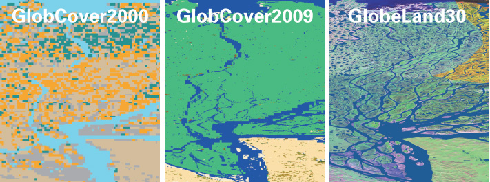
Comparison of global land cover products at different resolutions
The 2000 and 2010 GlobeLand30 datasets support monitoring and analysis of land cover change. They were produced by the same research team using consistent classification methods, which improves objectivity and comparability.
The information above is from Global Land Cover Data.
Download Process
The National Geographic Information Resource Catalog Service System provides GlobeLand30 datasets globally. After registration, the data can be downloaded for free.
Data Preview
The downloaded data is a compressed package such as N50_35_2010LC030.zip. After decompression, the files with the .tif extension are usually the ones needed.
Each tile package contains five parts: classification result files, coordinate information files, classification image map-index files, metadata files, and explanatory files.
You can upload all files to the cloud resource manager, or upload only n50_35_2010lc030.tif. The data information shows an unsigned integer pixel type and a 30 m resolution.
Download from iXGIS
iXGIS has downloaded the data from the source above and cached it in object storage. Users can download it directly from the Data Download tool in the toolbox. The download format is GeoTIFF.
iXGIS automatically merges and clips the data according to the specified extent.
China-region data download is supported.
Data Loading
GlobeLand30 also defines symbology. The code-to-color table is shown below.
| Code | Class | Description | RGB | Content Description |
|---|---|---|---|---|
| 10 | Cultivated Land | Cultivated land | 250,161,255 | Land used for agriculture, horticulture, and orchard cultivation |
| 20 | Forest | Forest | 0,99,0 | Land covered by trees with vegetation coverage above 30% |
| 30 | Grassland | Grassland | 99,255,0 | Land covered by natural grasses with coverage above 10% |
| 40 | Shrubland | Shrubland | 0,255,119 | Land covered by shrubs with coverage above 30% |
| 50 | Wetland | Wetland | 0,99,255 | Land covered by wetland vegetation or containing water bodies |
| 60 | Water Bodies | Water bodies | 0,0,255 | Water areas within land regions |
| 70 | Tundra | Tundra | 99,99,51 | Polar land covered by lichens, mosses, perennial cold-tolerant herbs, and shrubs |
| 80 | Artificial Surfaces | Artificial surfaces | 255,0,0 | Surfaces transformed by human activities |
| 90 | Bareland | Bareland | 191,191,191 | Land with vegetation coverage below 10% |
| 100 | Permanent Snow & Ice | Permanent snow and ice | 198,239,255 | Land covered by permanent snow, glaciers, and ice caps |
| 255 | None | None | 0,198,255 | None |
Data Processing
Pixels with a value of 0 are invalid areas, but the data does not explicitly define a NoData value. It is best to set NoData=0 for better display. You can re-export the raster with the raster export tool. Open the toolbox and use Raster Tools > Raster Processing > Assign NoData to assign invalid values. Depending on the dataset, set NoData=0 or NoData=255.